Direct Hire Recruitment for IT and Engineering

Recruitment Support That Delivers
Tier2Tek Staffing provides direct hire staffing and recruitment services for IT and engineering roles across a range of industries. As a trusted staffing agency, we help hiring managers and HR leaders find top candidates for long-term employment—no temp services involved. We deliver tailored recruitment solutions designed to match your organization’s technical needs, company culture, and hiring goals.
Whether you’re in tech, healthcare, energy, finance, manufacturing, or telecommunications, we understand the demands of your industry and can connect you with skilled professionals ready to make an impact.
Staffing Solutions Across Key Industries
At Tier2Tek Staffing, we aim to connect skilled professionals with top companies across diverse industries. Our focus goes beyond just filling positions; we provide customized recruitment and direct hire solutions. By understanding the specific needs of each industry, we ensure the right match between candidate skills and company requirements.

Information Technology (IT)
Navigating the dynamic landscape of IT, we connect businesses with specialists who drive technological innovation.
Engineering
From civil to electrical engineering, our expertise facilitates the sourcing of professionals who engineer the future.
Why Choose Tier2Tek Staffing?
Tier2Tek Staffing sets itself apart with a precise and thoughtful approach to matching candidates to your needs. Our deep industry knowledge and commitment to professionalism build trust and ensure a smooth recruitment process. We adapt quickly to market changes, using our network and technology to meet your staffing needs effectively. Partner with us for a reliable and efficient staffing solution.

Industry Knowledge
Access to Top Talent
Cost-Effective Hiring
Fast Communication
Flexible to Your Needs
Proven Success
Who We Work With
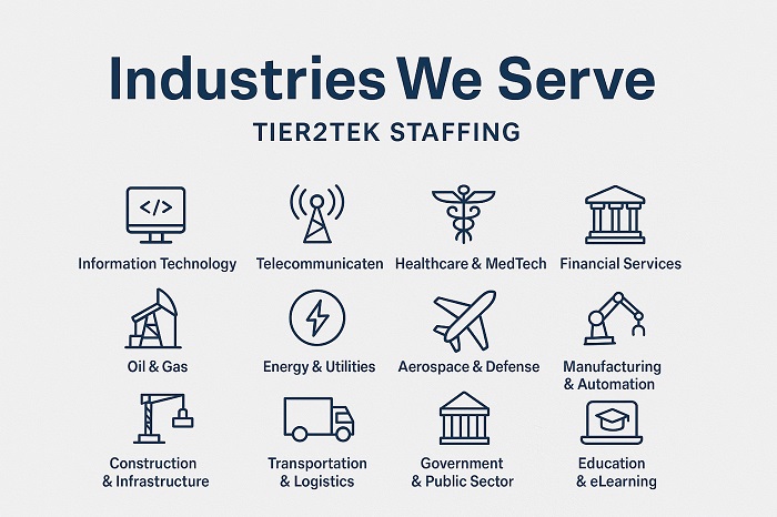
TTier2Tek Staffing provides direct hire staffing and recruitment for IT and engineering roles across a wide range of industries. As a trusted staffing agency, we help businesses—from startups to large enterprises—secure long-term talent without relying on temp agencies or temp services. Below is a comprehensive list of industries we support:
| Industry | Description |
|---|---|
| Information Technology | Software, cybersecurity, cloud, and infrastructure talent |
| Telecommunications | Network engineers, system architects, and support specialists |
| Healthcare & MedTech | Health IT, EMR/EHR systems, and medical device engineering |
| Financial Services | Fintech developers, data analysts, and IT auditors |
| Oil & Gas | SCADA engineers, IT support, automation, and control systems |
| Energy & Utilities | Renewable energy tech, grid management, and engineering roles |
| Aerospace & Defense | Cleared candidates, systems engineers, and security specialists |
| Manufacturing & Automation | Controls, robotics, and industrial systems engineers |
| Construction & Infrastructure | Civil engineers, project managers, and CAD professionals |
| Transportation & Logistics | Fleet management systems, supply chain IT, and software developers |
| Government & Public Sector | Federal, state, and local contracts with IT and engineering support |
| Education & eLearning | Learning management systems, IT admins, and instructional tech developers |
| Retail & E-commerce | IT support, eCommerce platforms, POS systems, and data analytics roles |
| Legal & Compliance | Legal tech, compliance systems, and cybersecurity support |
| Media & Entertainment | Streaming technology, content platforms, and UX/UI development |
| Hospitality & Travel | Reservation systems, customer experience platforms, and IT infrastructure |
| Real Estate & PropTech | Smart building tech, CRM integration, and data systems |
| Nonprofits & NGOs | Donor systems, CRM tools, and IT infrastructure for mission-based orgs |
| Insurance & InsurTech | Claims processing tech, data analytics, and policy management systems |
We adapt our recruitment strategies based on your industry’s specific hiring needs and technical requirements—ensuring the right talent for every role.
Where We Work
Tier2Tek provides direct hire staffing services nationwide across the United States and internationally in the UAE, Qatar, Saudi Arabia, and throughout Europe. Whether you’re expanding globally or filling critical roles locally, we’re here to support your recruitment efforts wherever you operate.
Our team is available 24 hours a day, Monday through Friday, to ensure fast communication and responsive service across all time zones.
Comprehensive Recruitment Process

Start Building Your IT and Engineering Team Today
Partner with Tier2Tek Staffing to find long-term talent that drives innovation and results. Whether you’re hiring in the U.S. or internationally, we’re ready to support your recruitment goals with a streamlined, flexible, and effective hiring process.
Let’s find the right fit for your team—contact us today.